Survey data is referenced to Louisiana South State Plane Coordinates North American Datum 1983 with soundings referenced below Mean Low Gulf in U.S. Survey Feet.
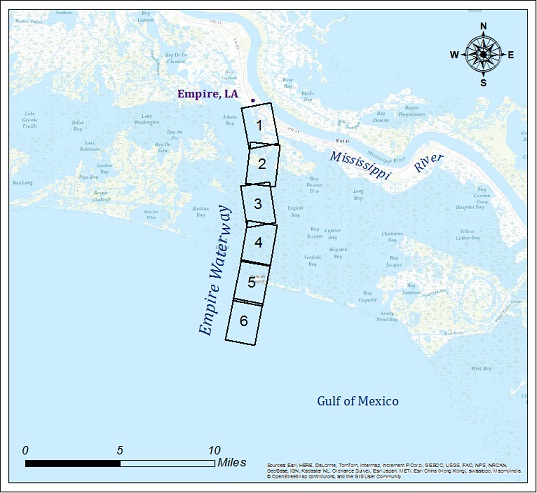
| Empire Waterway | |||
| Survey title | Survey date | ||
| Sheet Name River mile | XYZ | SHP | |
| Sh. 1 - Empire Floodgate | 08/07/2025 | ||
| EM_01_EFG | XYZ | Shape | |
| Sh. 2 - Bay | 08/07/2025 | ||
| EM_02_BAY | XYZ | Shape | |
| Sh. 3 - Bay | 08/07/2025 | ||
| EM_03_BAY | XYZ | Shape | |
| Sh. 4 - Bay | 08/07/2025 | ||
| EM_04_BAY | XYZ | Shape | |
| Sh. 5 - Bar | 08/07/2025 | ||
| EM_05_BAR | XYZ | Shape | |
| Sh. 6 - Bar | 08/07/2025 | ||
| EM_06_BAR | XYZ | Shape | |