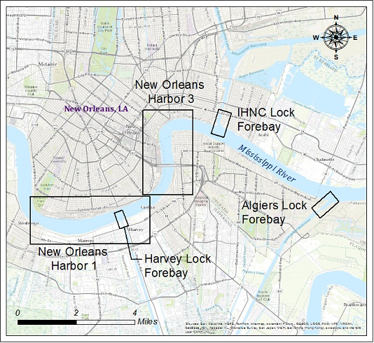
Survey data is referenced to Louisiana South State Plane Coordinates North American Datum 1983 with soundings referenced below Mean Low Gulf in U.S. Survey Feet.

| New Orleans Harbor Area | ||||||
| Survey title | Survey date | Survey date | ||||
| Sheet Name Stationing | Multi-beam | Single-Beam | ||||
| New Orleans Harbor - Sh. 1 | 10/30/2025 | 05/03/2016 | ||||
| MR_54_NO1 0+00 - 151+75 | XYZ | Shape | XYZ | Shape | ||
| New Orleans Harbor - Sh. 3 | 10/30/2025 | 07/11/2018 | ||||
| MR_56_NO3 226+00 - 333+05.61 | XYZ | Shape | XYZ | Shape | ||
| Algiers Lock Forebay | 09/24/2025 | 08/15/2018 | ||||
| LK_01_ALG 0+00 - 27+97 | XYZ | Shape | XYZ | Shape | ||
| I.H.N.C. Lock Forebay | 08/29/2025 | 08/15/2018 | ||||
| LK_02_IHN 0+00 - 33+27 | XYZ | Shape | XYZ | Shape | ||
| Harvey Lock Forebay | 08/29/2025 | 08/15/2018 | ||||
| LK_03_HVY 0+00 - 13+55 | XYZ | Shape | XYZ | Shape | ||